
Hurricane Erin, now a Category 3 storm, moved closer to North Carolina’s Outer Banks on Tuesday, bringing the threat of dangerous surf, flooding, and tropical-storm-force winds.
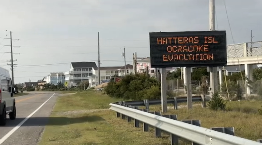
Although forecasts indicate the storm will likely remain offshore, officials ordered evacuations on parts of the Outer Banks, including Hatteras and Ocracoke Islands, due to concerns about rip currents, coastal flooding, and waves reaching up to 15 feet (4.6 meters).
Residents and business owners prepared for the storm’s impact. Holly Andrzejewski, who recently purchased the Atlantic Inn on Hatteras Island with her husband, said she had to reschedule incoming guests only days after taking ownership. The family secured the property by moving outdoor furniture and stocking generators, water, and flashlights.
“It’s always a possibility living here, and you just prepare as best you can,” Andrzejewski said, noting she and her family plan to stay on the island.

The National Hurricane Center reported Erin had maximum sustained winds of 115 mph (185 kph) early Tuesday, down slightly from previous days. The storm was located about 770 miles (1,240 kilometers) south-southeast of Cape Hatteras and moving northwest at about 7 mph (11 kph).
Tropical storm warnings remained in effect for the Turks and Caicos Islands, where authorities suspended government services, closed some ports, and advised residents to stay indoors. Coastal flooding along the Outer Banks was expected to begin Tuesday and last through Thursday.
Local officials have also reported storm-related incidents. On Monday, at least 60 swimmers were rescued from rip currents at Wrightsville Beach near Wilmington, according to the National Weather Service.
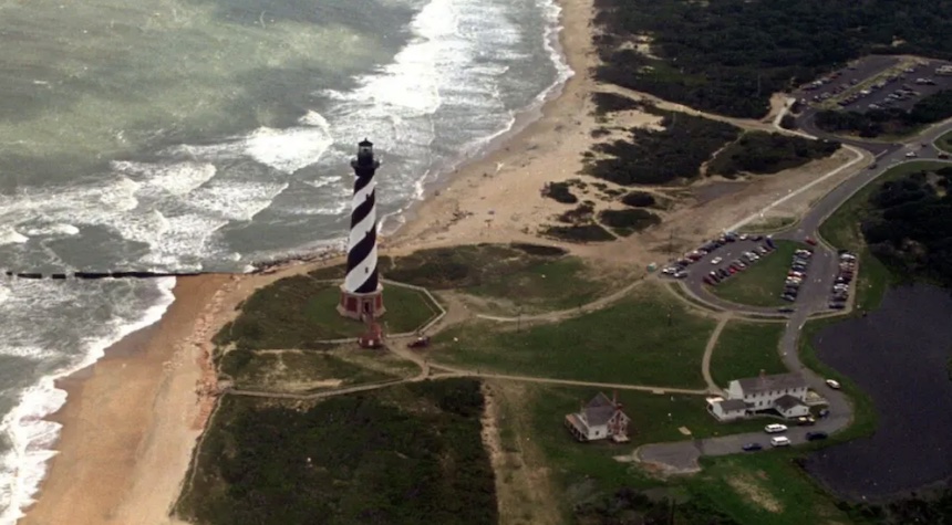
The evacuations come during peak tourist season in the Outer Banks, where storms often disrupt the thin stretch of barrier islands that extend into the Atlantic. Highway washouts and impassable routes remain a concern if conditions worsen. Ocracoke Island, which sustained its worst damage on record from Hurricane Dorian in 2019, is now under its first evacuation order since that storm.
Tommy Hutcherson, owner of Ocracoke’s only grocery store, said the community has largely recovered from Dorian but remains cautious. “You just never know,” he said. “I felt the same way about Dorian, and we got hit hard.”
While Erin is not forecast to make landfall in the United States, Bermuda could face the most direct impact later in the week. By Thursday evening, waves near the island could reach up to 24 feet (7 meters), according to the Bermuda Weather Service.
“Surfers, swimmers, and boaters must resist the temptation to go out,” Acting Minister of National Security Jache Adams said. “The waters will be very dangerous, and lives will be placed at risk.”
Scientists note that warmer ocean waters fueled by climate change are contributing to the rapid intensification of Atlantic hurricanes, enabling storms like Erin to strengthen more quickly and carry heavier rainfall.